Marine

The GPS built JUST for sailing with Bluetooth Wind Monitoring (required reading if you sail)

The GPS built JUST for sailing with Bluetooth Wind Monitoring (required reading if you sail)
View 10 Images
The Sailing GPS
1/10
The Sailing GPS
2/10
The Sailing GPS
3/10
The Sailing GPS
4/10
The Sailing GPS
5/10
The Sailing GPS
6/10
The Sailing GPS
7/10
The Sailing GPS
8/10
The Sailing GPS
9/10
The first anemometer in the world that can send wind speed and direction via Bluetooth to a handheld device. It is wireless, solar-powered and waterproof. Just attach to the masthead with two screws, and start using it.
10/10
The first anemometer in the world that can send wind speed and direction via Bluetooth to a handheld device. It is wireless, solar-powered and waterproof. Just attach to the masthead with two screws, and start using it.
View gallery - 10 images

One of the problems of using GPS chartplotters on a sailboat is that it is extremely difficult to calculate accurate arrival times given the amount of tacking often involved. Now there's a purpose-built Sailing GPS that not only accounts for the tacking that sailboats do, but can can tell you the optimal tacking angles and your Tacking Time to Destination (TTD).

Standard GPS chartplotters do not account for the fact that sailboats tack back and forth, so it makes sense that if they don't know your tacking distances, how can they calculate your Estimated Time of Arrival (ETA) correctly? The Sailing GPS solves this problem. It displays exactly how far each tack is, how long it will take to sail each tack, and the optimal tacks to arrive earliest. Pretty amazing.

You can also use Google Maps to easily mark waypoints, connecting via Bluetooth with the Sailing GPS, which is much easier than manually entering long strings of numbers for the latitude/longitude of multiple waypoints.

The Sailing GPS can even learn the unique "polar plots" for your individual vessel.

This is not just a generic polar plot for all sailboats of a certain type, or estimates from a simulation - the Sailing GPS learns your unique vessel's actual performance on all different points of sail.

It can then calculate your optimal tacking routes and Tacking Time to Destination (TTD). Later, you can transfer the polar plot data via Bluetooth to a PC, if you want to see your boat's unique speed profile across wind angles and wind speeds.

SailTimer Inc., the manufacturer of The Sailing GPS, received final patent approval in March of this year for its pioneering R&D.; "This technology is a big step forward for sailors" said Dr. Craig Summers, the President of SailTimer Inc.:

"People assume that since GPS satellites can pinpoint our location on the Earth, everything shown on a GPS chartplotter must be very accurate", said Dr. Craig Summers, the President of SailTimer, "but if you head upwind on a tack, standard GPS units view your tack as cross-track 'error'."

"They also don’t account for tacking distances in your ETA, and even if your speed remains constant VMG decreases all by itself the longer you stay on the tack. In the digital age, sailors need a GPS that displays simple, safe, correct information."

The new patent, titled 'Navigational Planning and Display Method for the Sailor's Dilemma When Heading Upwind', was granted by the US Patent and Trademark Office this year, and originally filed in 2006.

The first anemometer in the world that can send wind speed and direction via Bluetooth to a handheld device. It is wireless, solar-powered and waterproof. Just attach to the masthead with two screws, and start using it.

The navigation functions in The Sailing GPS include support for the new wireless, solar-powered SailTimer Wind Vane which will be available this (Northern Hemisphere) summer, offering the ability to continuously update your optimal tacks with real-time wind data via Bluetooth.

The Sailing GPS comes with a free waterproof DryPak soft bag with tie-downs.

Unlike smartphones and tablets, the Sailing GPS is just as easy to see in direct sunlight, and with polarized sunglasses on.

The screen of the Sailing GPS is protected by Lexan, which is very strong and won't break if it's dropped, and ... it floats.

The polycarbonate Sailing GPS case is scratch- and UV-resistant, small enough for a coat pocket, and durable enough to remain unharmed with a bit of rough treatment, which is much easier than trying to protect and view an iPad in the cockpit (and the ETA won't go blank every time you tack).

The Sailing GPS displays your tacking angles in a diagram and in degrees for each heading, but is not intended to replace a chartplotter. Nevertheless, even fully-equipped cruising yachts will not have the features provided by The Sailing GPS, including the quick and easy display of your optimal tacks and Tacking Time to Destination (TTD).

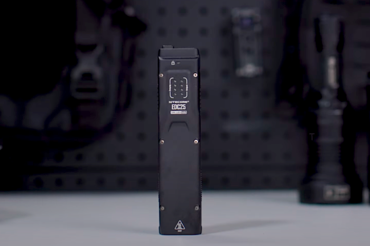
The Sailing GPS costs US$399 and can be purchased online.

The Sailing GPS - Basic Operations

View gallery - 10 images
5 comments
5 comments
Andy Barrow
Nice first try - the screen seems a little small for use on a boat, and it needs an integrated compass, rather than using motion. It's not true that "fully equipped sailboats don't have this feature". Routing software such as Expedition or Dockman are quite capable of doing the same thing, as well as taking inputs from the yachts NMEA bus.
It needs a way to mount on the boat, similar to GPS enabled devices like TacTic or Veloctec SC-1. BIG DISPLAY.
It also needs a way to interface with a PC for uploading/downloading of track and waypoint information, as well as uploading polars.
Sailor
Out of all of the features you mention, isn't this the one product that pulls them all together best?
Standard GPS chartplotters on fully-equipped cruising sailboats do not have the basic features offered by the unit above: display optimal tacks, Tacking Time to Destination and polar plot learning. That is what sailors need. 99.9% of the cruising sailboats out there with a GPS chartplotter can only display ETA, and don't account for tacking distances. But ETA is for power boats.
The Deckman and Expedition software cost 200-300% more than this entire GPS, and require a laptop while sailing. Not everyone wants to use a computer while sailing, or has a safe, dry place to view it (which is also out of direct sunlight). Yes, B&G purchased Deckman, but their units cannot learn actual polar data on your individual vessel, and cost ten times more than The Sailing GPS above.
You can see in the YouTube clip and pictures of the keypad that this unit has simple buttons for ease of use -- more like a 1-button iPad, not a control panel of variables rivalling a Boeing 747. Just enter the directions of the Wind + Bearing, and press Optimal Route.
You can also see tie-down loops for easy mounting on the waterproof DryPak in the pictures above.
For interfacing with a PC: The article above does mention that The Sailing GPS has Bluetooth to send the polars it learns for your unique vessel to a PC, or to easily transfer waypoints through the air from Google Maps on a PC.
Gringo
I heard him mention that this will give you "boat heading". However, I didn't hear anything about an integral compass.
GPS receivers alone cannot tell you what the boat's 'heading' is. They can tell you what direction you are traveling but without compass imput they have no idea which way the bow of the boat is acutally pointing. You could be "headed" north, for example, and in reverse, and the GPS doesn't know that you're facing the other way. It only knows which direction the antenna is travelling. This doesn't translate to a GPS reading of actual heading.
Xavier
You can always improve on anything, but for a 1st version this certainly look impressive and reasonably priced for boat gear.
Ansa
I'd really like to have this kind of functionality on my sailboat and if I had no instruments on board I'd consider this. However, I have full Raymarine instrumentation and can't bear the thought of buying yet another wind instrument. How cool it would be if someone invented a black box that listened to the SeaTalk buss, broadcast all the data on bluetooth or wi-fi and then invented another portable box like the Sailing GPS that had the software required to tacking planning and collect performance data. This could probably be done for NMEA systems as well. What this would do is get all the boat data out in the open where custom software could deal with it, instead of having yet another GPS and compass and wind instrument on board.