Maps
-
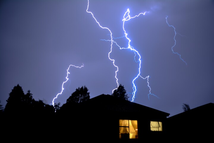 Do you live in a lightning hotspot? A new set of maps shows just where all that discharged electricity makes contact with the ground across the United States each year. Tip: If you're worried about getting hit, you might want to skip Florida.
 -
 Researchers have mapped where and how strongly we experience different kinds of love, covering everything from romantic love to love for strangers. The findings shed light on how context and the object of love affects our subjective feelings of it.
 -
 Using old insurance maps, researchers enabled a machine-learning system to create 3D models of neighborhoods that no longer exist. The technique could lead to VR tours of the 'hoods, as well as provide data on the various impacts of urbanization.
 -
 If you’re looking for some Red Planet real estate, there’s a new tool that could help you pick out the very best spot. Caltech scientists have created a nearly complete global map of Mars at an extremely high resolution of 5 m (16.4 ft) per pixel.
 -
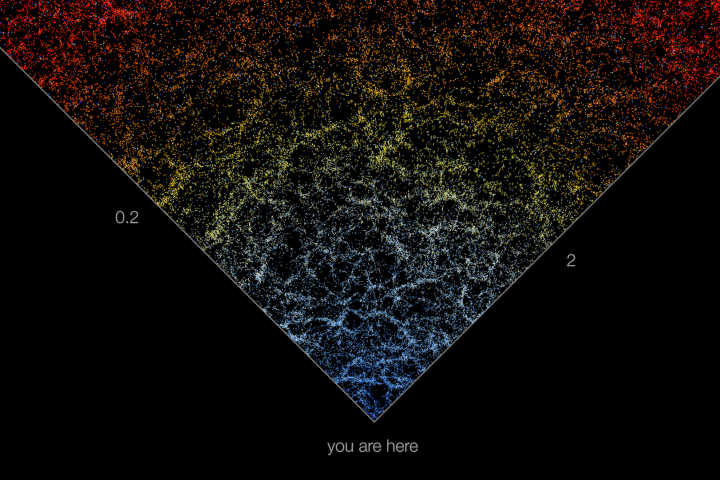 Astronomers at Johns Hopkins University have created an interactive map of the universe, charting the positions and colors of 200,000 galaxies stretching from here to the very edge of the observable universe.
 -
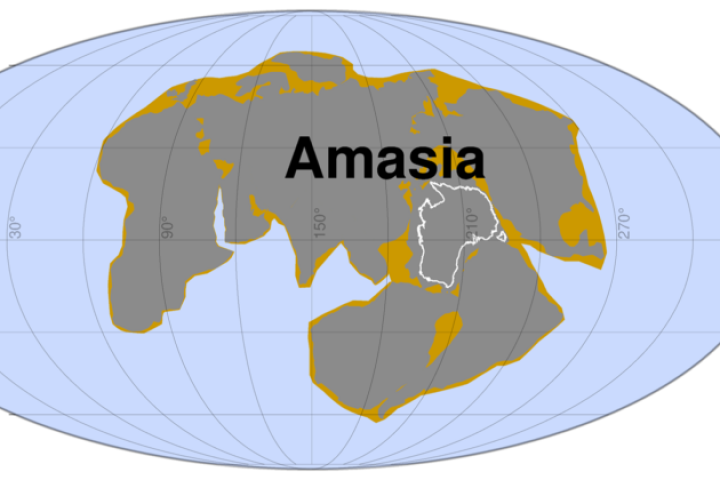 New modeling from researchers at Curtin University has simulated 300 million years of tectonic plate movement to predict the formation of a supercontinent called Amasia. The modeling estimates the Pacific Ocean closing and America colliding with Asia.
 -
 An international team of scientists and cartographers has released the most detailed map of the seafloor of the Southern Ocean that surrounds Antarctica. It covers 48 million km² and includes the deepest spot yet found in the region.
 -
 It is said that we know more about the surface of Mars than the seafloor. A new technique could help us fill in the blanks by using deep-dwelling rays to survey the seabed for us, and possibly even power the required hardware themselves.
 -
 Newly released maps of Zealandia, a massive sunken landmass, are revealing the topography of this underwater land in unprecedented detail. An interactive website has also been launched allowing users dynamic ways to explore the new data.
 -
 ESA has released a series of maps that let viewers track the amount of permafrost present around the Arctic. Melting of permafrost could add massive amounts of greenhouse gasses to the atmosphere, worsening the effects of climate change.
 -
 In some ways, the most Earth-like world in our solar system is Saturn’s largest moon, Titan. And now, astronomers from NASA JPL and Arizona State University have used years of Cassini data to construct the first global map of Titan.
 -
 Air travellers have become fairly used to onboard live flight maps, that show how far their plane is from its destination. Canadian airline WestJet is now introducing a device that projects such maps within children's bedrooms, letting them know how soon their parents will be home.
Load More