ESA
-
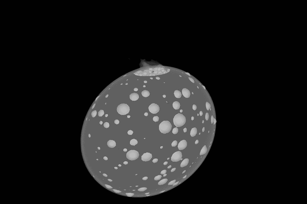 When NASA's DART deep space probe smashed into the asteroid Dimorphos, it didn't leave a crater. Instead, there was a splash, where the asteroid was distorted like a jelly as its entire structure shifted.
 -
 The youngest neutron star detected so far turned 37 years old last week. To celebrate, James Webb Space Telescope has finally found the most direct evidence of it, hiding among the remains of the supernova cloud it was born in.
 -
 Data from ESA's Mars Express indicates that there may be subterranean ice deposits at the Martian equator that are up to 2.3 miles (3.7 km) thick. With enough water to fill the Red Sea, this could be a tremendous resource for future Mars colonies.
 -
 Hubble has helped astronomers measure changes in the weather on an exoplanet. Forecasts for the planet Tylos predict a gigantic hurricane today with a top of over 3,000 °F (1,650 °C), followed by a strong chance of showers of molten iron tonight.
 -
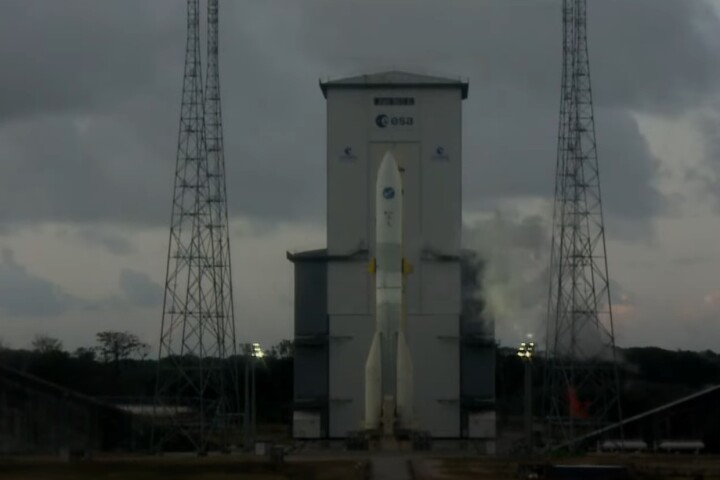 ESA's next-generation Ariane 6 heavy rocket came another step closer to flight on November 23, 2023 as it completed a long-duration hot-fire test of the stacked booster's Vulcain 2.1 engine at Europe’s Spaceport in Kourou, French Guiana.
 -
 The European Space Agency (ESA), Airbus Defence and Space, and Voyager Space have signed a technology agreement that gives us a glimpse at space exploration and exploitation beyond the retirement of the International Space Station (ISS).
 -
 ESA has released the first five images from its Euclid space telescope that reveal unprecedented high-resolution pictures that cover large areas of the sky in a single shot, demonstrating its capabilities for its upcoming dark matter survey.
 -
 In anticipation of a photographic bonanza, NASA and ESA are testing the new Handheld Universal Lunar Camera (HULC), which will be carried by future astronauts to record their adventures in images and video when they return to the Moon in a few years.
 -
 NASA’s InSight listened out for seismic activity on Mars, and last year it picked up a marsquake so big it was suspected to be a meteoroid impact. Now, thanks to the cooperation of all agencies with orbiters around Mars, the source has been tracked.
 -
 The Moon is a dusty place, so to tidy things up a bit, ESA is experimenting with high-energy lasers and simulated lunar soil to explore the possibility of sintering lunar regolith to pave roads and landing fields for future lunar outposts.
 -
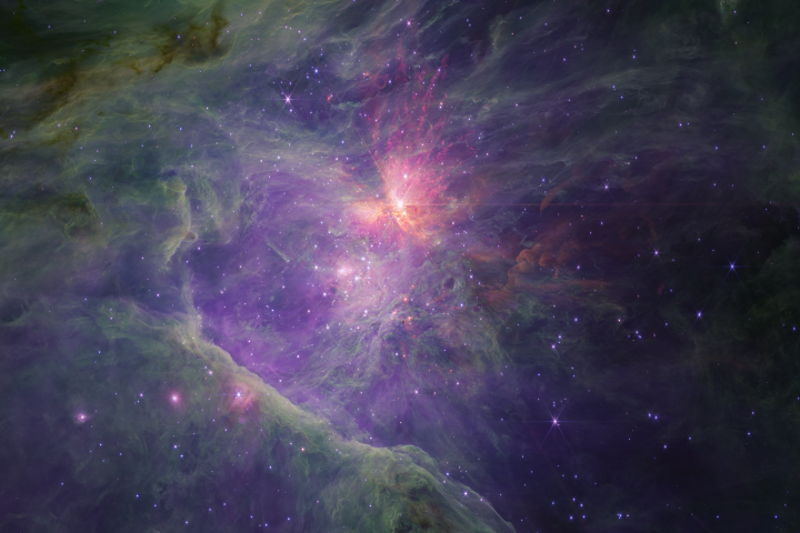 Hiding within new images of a nebula captured by the James Webb Space Telescope, astronomers have made a puzzling discovery – dozens of Jupiter-sized objects that defy explanation.
 -
 Imperial College is developing a rocket thruster called the Iridium Catalysed Electrolysis CubeSat Thruster (ICE-Cube Thruster) that is so small that it can only be fabricated using techniques originally designed for making silicon chips.
Load More