ESA's Sentinel-1A satellite has returned its first images of Earth from space in its second week of achieving orbit. The satellite, having been launched on Apr. 3. has only recently undergone a complicated maneuver to extend its 10 m (32 ft) solar wings and 12 m (39 ft) radar imaging array.
There are due to be six constellations of two Sentinel satellites designed to image the Earth, in part to observe climate change as a part of the Copernicus program. The satellite is not yet positioned in its operational orbit, nor is it fully calibrated to supply true data to the mission. However, the images taken on Apr. 12 are a truly stunning example of the observational capabilities of the cutting-edge satellite.
“We are in very early days of the satellite’s life in orbit and ground segment operations” states Volker Liebig, Director of ESA’s Earth Observation Programmes. He continues, “these images certainly demonstrate the calibre of data this advanced radar mission will bring from its different imaging modes, and how it will provide essential data for Copernicus services to benefit us all.”
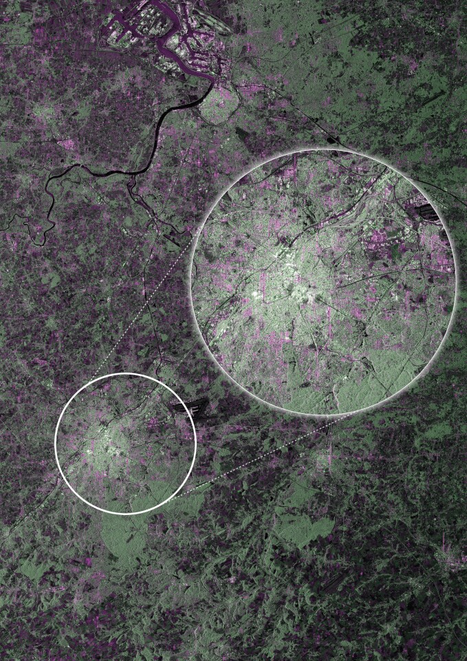
The first image (above) features Brussels, the seat of the European Commission tasked with administering the Copernicus program. The image, captured nine days after launch, was taken using the satellite's Strip Map mode, which captures a swath measuring 80 km (50 miles). This shot displays the dense urban area of Brussels as a lighter colored patch, contrasting with the darker vegetation surrounding the city.
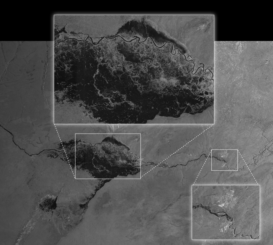
The Sentinel-1A satellite's ability to see through cloud cover even at night with the use of radar imaging, may prove to be vital in monitoring flood areas and transmitting topographical data to emergency services, allowing them to plan and expedite rescue efforts. This feature is showcased in the photo below, displaying a radar image of an area of Namibia heavily flooded by water emanating from the Zambezi river. The photo was captured using the Sentinel's main Interferometric Wide Swath mode which images a width of 250 km (155 miles) in dual polarization.
Over the next three months, the satellite will run through its commissioning phase, during which it will achieve operational orbit and be calibrated to begin what will be the most ambitious and largest Earth observation mission ever undertaken.
The video below demonstrates the maneuver undertaken by the Sentinel-1A satellite in order to unfurl its solar panels and radar imaging array.
Source: ESA