Navigation
-
 The Beeline Moto is likely the simplest, most user-friendly electronic motorcycle navigation device you can buy. Its new successor, the Moto II, keeps things simple but adds some handy new features like a mini map view.
 -
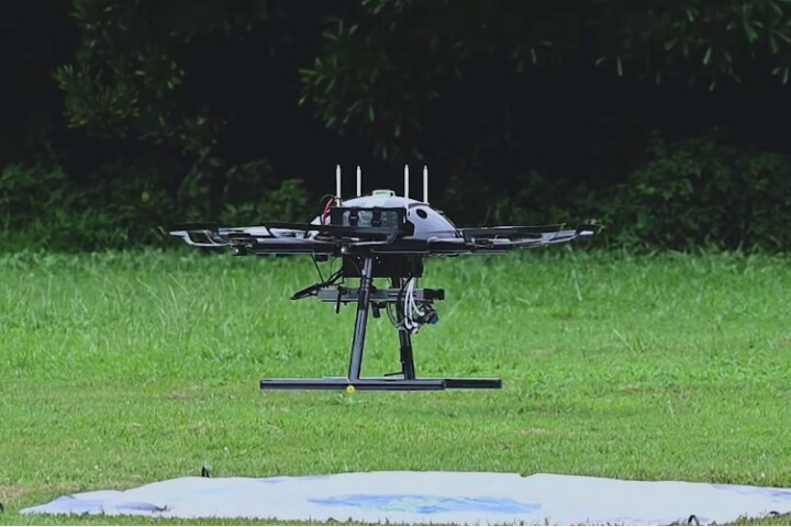 When it comes to locating landing pads or other landmarks, drones rely largely on visual cues. So, what happens if it's dark or foggy, and there's no ground-based power for lights? Well, that's where the Millisign system is intended to come in.
 -
 In recent years, we've heard about navigational systems which guide pedestrians via vibrating actuators in their shoes. The FeetThrough system takes a different and reportedly better approach, by actually shocking the soles of the feet.
 -
 Augmented reality eyewear is great for providing turn-by-turn navigational cues, but a lot of the goggles and visors have a kind of tech-nerdy vibe. Blucap Moto sunglasses are different, in that they won't make you look like a Sheldon Cooper wannabe.
 -
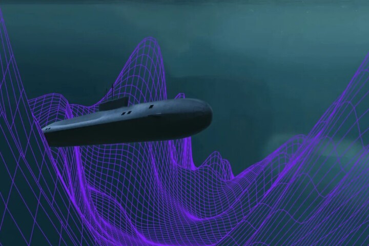 Using very small atoms to guide very large submarines, Q-CTRL has been awarded a contract by the Australian Department of Defence to develop quantum mechanics systems for the AUKUS treaty partners to navigate subs on long underwater missions.
 -
 GPS doesn’t work as well inside buildings, underground or underwater. Now engineers in Japan have developed and tested an alternative technology that uses cosmic rays to track movement beneath a building with precision of a few meters.
 -
 Garmin has added solar charging to its latest Edge bike computer, which boasts up to 100 hours of per-charge battery life, improved GPS accuracy, more ride analytics, easy setup out of the box and a refreshed user interface.
 -
 Because GPS doesn't work indoors, it can be difficult for robots to determine where they are within a structure. A new system could help, by using a building's existing Wi-Fi access points to guide wheeled or walking robots.
 -
 NASA and partners are developing backpack-sized technology for future Moon explorers that will allow them to map and navigate the lunar surface in the darkness of the high polar regions to within a centimeter without GPS.
 -
 Hot on the heels of Facebook's Ray-Ban Stories comes a pair of concept smart glasses from Chinese tech firm Xiaomi that don't just push notifications from a smartphone, but also sport some nifty independent functionality.
 -
 While many cyclists use apps such as Google Maps to navigate city streets, glancing down at that cluttered map display can be confusing. The Beeline Velo 2, however, is designed to keep things simple and easy to read.
 -
 Airtext has released a simple laser altimeter for small aircraft to make approaches and landings safer. The app-controlled Land-DAR (Land Distance and Ranging) is configured through an app and calls out altitudes as the aircraft descends.
Load More