

Monday November 24, 2003
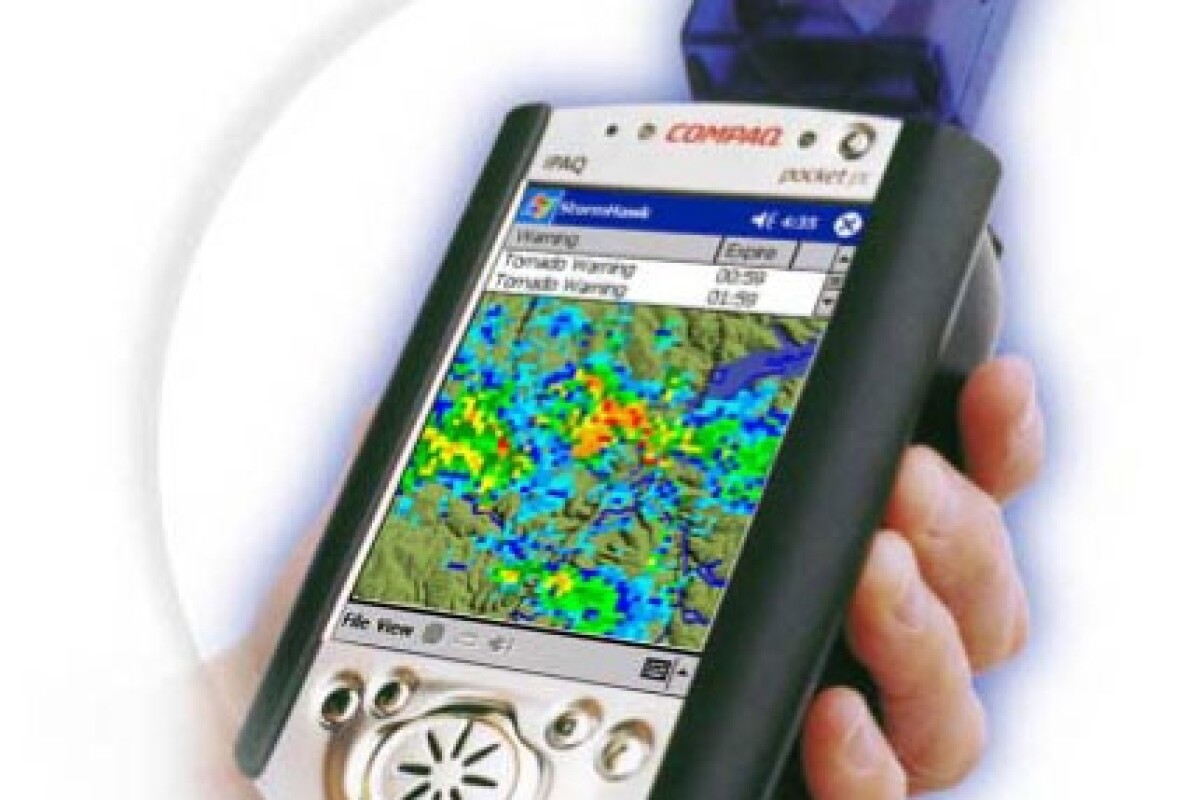
Storm Hawk is a hand-held weather forecasting and GPS-based mapping device designed to give motorists, recreational boat users or hikers critical, real-time information about what to expect up ahead as well as improve safety for businesses with weather sensitive operations.
Currently only supported in the US where it will become available in December 2003, Storm Hawk uses a HP/Compaq iPAQ personal digital assistant as the basis for providing detailed colour maps overlaid with weather-radar and other relevant information such as temperature, visibility, lightning, wind speed and current weather advice.
The device has an integrated zoom function (one mile to 250 miles) and the orientation of the map automatically rotates on the display so as to correspond to the direction of travel.
On-demand download of radar data takes less than one minute via a cellular or satellite network and a future version is in planning that will include predicted radar - which shows the location of storms ten to 30 minutes into the future - and prediction of cloud-to-ground lightning with up to 97 percent accuracy.
Special features for marine use include charts for the U.S. and surrounding coastal waters and reports on wave height, buoy observations, high surf advisories and tides.
The Storm Hawk package costs US$1,595 and includes Storm Hawk software, HP/Compaq iPAQ PDA, HP dual-slot expansion pack, PC card GPS, and a Sprint AirCard.
The satellite phone package costs US$1850 and all users also need to subscribe to monthly cellular or satellite phone service and pay a US$9.95 monthly subscription to use Storm Hawk.
Storm Hawk only works within the United States and surrounding U.S. waters at this time. Check back to www.Gizmo.com.au for updates as they become available.


